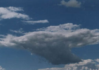
Above: Cumulus Pannus
Cumulus Pannus
Cumulus pannus are shreds or patches of clouds which are large, cottony or even puffy in nature and usually pass underneath the major cumulus clouds. In fact, they are usually shredded off the cumulus clouds hence belonging to this class of convection clouds. They are also classified under the vertically developed clouds. These dark shreds of clouds come as a result of condensation which forms in the widely saturated air of rainfall. It happens that they will hang as shreds below the rain cloud when the winds tend to be gentle and will have ragged appearance when in high winds.
What height are cumulus pannus clouds found?
It is typical to have the cloud base of these pannus clouds sitting between two thousand and three thousand feet in altitude. They are therefore categorized under the low-level clouds. They can travel at speeds of about twenty five miles per hour, depending on the intensity of the wind that is moving them.
Classification of cumulus pannus clouds
- Cumulonimbus pannus
These belong to the cumulonimbus clouds and are seen during storms when moving in different directions from the major cumulonimbus clouds. They are shredded off the cumulonimbus clouds too.
- Altostratus pannus
These shreds pass underneath the altostratus clouds and they also belong to the altostratus clouds since they are shredded off them.
- Nimbostratus pannus
These clouds pass underneath the nimbostratus clouds which also happen to be the rain bearing clouds commonly known by the name stratus. This classification of pannus clouds shreds off the nimbostratus clouds
How are cumulus pannus clouds formed?
These clouds are formed through the condensation process. Warm air rises hitting against the freezing air surrounding it until the temperatures go down reaching the dew point. It is from this moment that droplets of water are formed and are likely to cause the rain. These pannus clouds sit under the belly of the rain clouds and they constitute a layer which separates them from the main rain clouds.
What do cumulus pannus look like?
These are dark looking patches of clouds which lie under the belly of the rain clouds. They are hard to be noticed though, and during high winds, these dark shreds appear ragged. When the pannus clouds are seen, if it is not already raining, then this can take place imminently. Frazzles are also possible to be seen at the cloud’s bottom side.
How common are cumulus pannus clouds?
These clouds are not common to be spotted in fact; only ardent spotters of clouds can see them and very few can notice the cumulus pannus clouds. When spotted, it is likely that in the next two to three minutes, there will be a pour of rain. Since they form a layer between them and the rain clouds, they are likely to cause darkness immediately as they cover the layers above.
Where can I see the cumulus pannus clouds?
These clouds can be seen around the globe except in Antarctica since it is very cold there.
