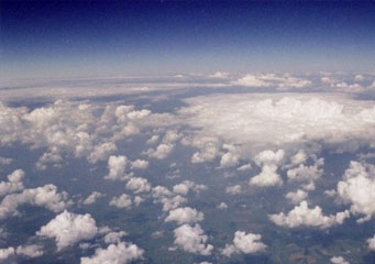
Above: Cumulus Mediocris
Cumulus Mediocris
The shapes, size and colors of clouds are part of the means employed by meteorologists in order to foretell the weather and, consequentially, assemble an accurate forecast. Although most people are aware that clouds can be included in any of the three major categories (stratus, cumulus and cirrus) a certified meteorologist or other savvies of this field can easily differentiate between a plethora of cloud subgenres using the less-known criteria.
In essence, the attribute coupled with the major cloud category will generally convey the characteristic that distinguishes it from the rest of its counterparts from that family. Some attributes will be related to the altitude at which the cloud can be found, such as in the case of cumulus mediocris, indicating that more often than not it will be found at medium altitudes. On the other hand, other attributes, such as cumulus praecipitatio will point out a meteorological condition associated with this cloud and others such as cumulus tuba will attempt to depict the shape.
How do cumulus mediocris clouds look like?
The general color that can be expected from cumulus mediocris clouds is grey, although the shades tend to vary a great deal. As far as the shape is concerned, the cumulus mediocris presents several puffy, sometimes overblown-like patterns. However, it is important to note that although grey colored clouds are usually associated with precipitations; this rule does not apply in the case of the cumulus mediocris. The overblown aspect can be justified through the perspective of the clouds dimensions: the mediocris is part of those special clouds that have an even width and height, which grants them a rather consistent look. As a side note, although the height of the cumulus mediocris cannot be accurately estimated via a ground observation, their foundation will appear smooth.
What height are the cumulus mediocris clouds found?
As mentioned above, the altitude that is generally associated with the mediocris formation is medium. More precisely, these cloud formations are usually located between the 2 and 4 thousand feet sections of the troposphere. It is, on the other hand, important to note that the altitude is also dependent on the level of moisture in the air. Therefore, it would not be unusual to find cumulus mediocris clouds in the 10 or even 15 thousand feet sections of the atmosphere. In essence, the mediocris formations are considered the buffer between low humidity clouds at high altitudes and their high humidity counterparts in the lower elevations.
How common are cumulus mediocris clouds?
The cumulus mediocris is typical for the warm seasons and all parts of the world and their shapes can be observed best during the afternoons or early mornings. However, their ability to maintain their basic shape is related to the wind conditions and will sometimes diverge into other formations like:
- Fractus
- Pannus
- Velum
- Arcus
How are the cumulus mediocris clouds formed?
The process dubbed convection, which refers to a mass of air elevating is what gives birth to the cumulus mediocris formations. A critical factor to their formation is the extent of the plane which radiates the warm air in the shape of bubbles. Gradually, the warm air radiated by the ground will chill and created the cloud formations.
Where can I see cumulus mediocris clouds?
In essence, since the mediocris clouds are born via convection, any climate but the polar one should do just fine.
