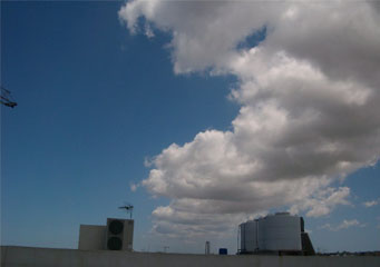
Above: Cumulus Arcus
Cumulus Arcus
The cumulus clouds may also be referred to as favorable weather clouds though they are known to cause turbulent weather at times. Therefore an arcus cloud formation is a horizontally formed cloud and it is a low level cloud which usually produces a drizzle or rain.
What height are cumulus arcus clouds found?
Clouds are located at varying heights in the sky. These cumulus clouds are low level clouds and go up to 3000 meters in height.
Classification of cumulus arcus clouds
The cumulus arcus clouds can be classified into two types of cloud formations namely:
- Shelf clouds
- Roll clouds
The shelf arcus cloud comes about as a result of thunderstorm outflow. It is also a low horizontal arcus cloud that has a wedge shape. The shelf cumulus cloud usually appears at the edge of a storm unlike the wall cloud that is usually mistaken for the shelf arcus which appears at the back of the storm. The other cloud formation found in the arcus is the roll cloud. The roll cloud has a horizontal tube shape. The cloud differs from its counterpart the shelf cloud due to the fact it usually seems to go around its axis horizontally. These roll clouds come about as a result of sea breezes and also through cold fronts and cold air outflows. Unlike its counterpart it does not occur during thunderstorms.
The arcus cloud referred to as the shelf has a horizontal wedged composition and is also a low kind of cloud formation. The other cloud formation referred to as the roll is unique because it does share the common features with other cloud formations. It seems to be rolling about and they do not change their speed or shape.
How are cumulus arcus clouds formed?
Usually clouds are formed when the process of condensation takes place. This process occurs when the cool rising air and the moisture found in it cools down and falls down as water droplets. During the condensation process the moist warm air will cool and the warm air will condense leading to cloud formation. There is a type of arcus cloud formation that comes about as a result of outflows of cold air from cold fronts where there are no thunderstorms. The other type is formed due to thunderstorm outflow.
What do cumulus arcus clouds look like?
The arcus cloud referred to as the shield cloud is usually seen on the edge of an oncoming storm and may at times be mistaken for a wall cloud. The difference in their appearance is due to the fact that unlike the shelf cloud the wall cloud is found at the back of an approaching storm. The roll cumulus arcus clouds are horizontal and have a tube shape and they appear to be always spinning or rolling around their own axis horizontally.
How common are cumulus arcus clouds?
Arcus clouds are visible during the winter and there is a warning that extra caution should be exercised once these clouds are spotted.
Where can I see cumulus arcus clouds?
These clouds can be seen in different regions of the world namely:
- Queensland Australia
- California
- The English channel
- Shetland Islands
- Ontario
