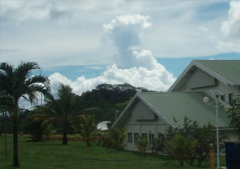
Above: Cumulus Castellanus
Cumulus Castellanus
The clouds are classified in different categories depending upon the height of the cloud’s base with reference to earth’s surface. There are some types of clouds that are not categorized with respect to height. There are high, middle and low clouds and the most popular cloud is the cumulus cloud. Cumulus clouds have different types, the most common types include:
- Cumulus fractus
- Cumulus congestus
- Cumulus pileus
- Cumulus humilis
- Cumulus castellanus
However, note that this article deals with cumulus castellanus clouds in particular.
What are cumulus castellanus clouds?
On the whole, cumulus castellanus clouds are different types of cumulus clouds that can be easily identified from the multiple towers they display from their top. The vertical air movements are clearly visible in these clouds. They have got their name because of the resemblance they show with the crenellation of the medieval castles and these clouds are considered to be an indicator of thunderstorms or forthcoming showers.
What height are cumulus castellanus clouds found?
Cumulus castellanus can sometimes get quite tall. There are times when the top of these clouds are as high as middle level clouds or even high level clouds while maintaining their bases at a low level. They never lose their flat base and only tend to grow vertically. These clouds are formed at a height of 330ft above ground level. The fact that cumulus castellanus has a flat base clearly indicates that water vapor does not condense till the time it reaches a certain height. As water vapors move upwards, these clouds attain the fluffy shape.
How are cumulus castellanus formed?
Just like any other type of clouds, they are formed when air water vapors move upwards and later condense when they reach a certain height above the earth level. Certain climatic conditions are to be met for the formation of cumulus castellanus clouds. As mentioned earlier they are formed right before a thunderstorm and are also seen under fair weather conditions. Several other types of clouds like cumulonimbus clouds are formed by cumulus castellanus when they experience different weather conditions. Although they are formed very close to the earth’s surface, they can get really huge because of their tendency to rise vertically. If they keep on getting the required amount of rising air, they can then keep on rising and eventually result in thunderstorms. Cumulus clouds can attain the height of up to 20000ft if they receive sufficient moisture content in the air.
What do cumulus castellanus clouds look like?
Cumulus castellanus clouds are usually white or grey in color with a strong resemblance to floating cotton balls. Their fluffy shape makes them unique and easy to be indentified from other types of clouds. They do not have much width but do have vertical height which is easy to see when viewed from the side.
How common are cumulus castellanus clouds?
Cumulus clouds are generally known as low level clouds and contain water droplets that cause drizzle. The very first image of clouds when someone mentions clouds is very similar to cumulus castellanus clouds. They have huge projections and this is what makes them most prominent from other types of cumulus clouds and are often considered to be an indicator of thunderstorms and thus can be easily seen at that time.
