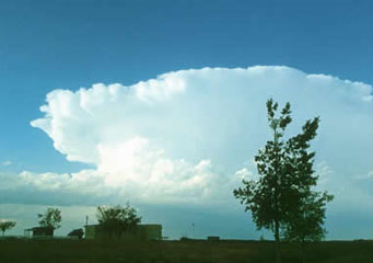
Above: Cumulonimbus
Cumulonimbus
From April to June, cumulonimbus clouds form reliably on each evening in Midwestern US. These clouds offer some of the most amazing backdrops the planet has ever witnessed. Not only are cumulonimbus clouds breathtaking and a spectacle to be respected, but they can also turn mean instantly.
What are cumulonimbus clouds?
Also termed to as rain or storm clouds, cumulonimbus clouds are one of the most dynamic, beautiful and spectacular clouds formation on offer. Cumulonimbus clouds are by far the most spectacular and intriguing of all cloud formations. With the raw power that they often exert, they have captured the hearts of many the world over. The open fury they produce knows no boundaries and no manmade structure is safe from this phenomenon that is the “Tornado Alley” in the United States of America.
Types of cumulonimbus clouds
- Cumulonimbus calvus
- Cumulonimbus capillatus
- Cumulonimbus incus
- Cumulonimbus mamma
- Cumulonimbus pannus
- Cumulonimbus pileus
- Cumulonimbus praecipitatio
- Cumulonimbus tuba
What height are cumulonimbus clouds found?
Cumulonimbus clouds are one type of low altitude clouds. Their base is normally not more than a thousand feet above the ground, though they can sometimes reach a height of seventy five thousand feet above the earth’s surface. Sometimes, they form as a single tower or as a row of towers which is also known as a “squall line” by some people. Associated with these clouds is lighting, violet tornadoes, snowstorms, thunderstorms and hail.
How are cumulonimbus clouds formed?
Cumulonimbus clouds are formed when a low pressure center develops with a high pressure system around it. The combination of these two opposing forces creates heavy winds that result into the formation of cumulonimbus clouds. Depending on how unstable the atmosphere is, these clouds will grow taller and taller. The formation of cumulonimbus clouds is also affected by the movement of air currents.
Below are some characteristic of cumulonimbus clouds.
- Dark or grey in appearance.
- They carry a huge amounts of water that come down as rain.
- They cause thunderstorms, snowstorms or hailstorms.
- They are formed as a result of warm air meeting with cold air, especially in humid conditions
- Cumulonimbus clouds spread across the sky uniformly and are low altitude.
How do cumulonimbus clouds look like?
Generally, cumulonimbus clouds look like an impressive tower or towers, are dark in color and this is because they are heavily laden with tiny water droplets. Cumulonimbus clouds are the biggest clouds and have the capacity to hold millions of tons of water that falls down as rain, hail, snow or sleet.
How common are cumulonimbus clouds?
Cumulonimbus clouds form at varying heights as explained above. Their formation is governed by the amount of moisture present in the surrounding air. They can also be dictated by the convection of heat in the surrounding air. By nature, cold air sinks while warm air rises and as the atmosphere tries to re-stabilize itself, cumulonimbus cloud forms. Cumulonimbus clouds form in the lower part of the atmosphere and are very common just before a thunderstorm, snowstorm or a heavy rain downpour.
Where can I see cumulonimbus clouds?
On hot and humid days, you will often see cumulonimbus clouds forming and are a worldwide natural phenomenon. These clouds are puffy in appearance and have either rounded or flat bases. They vary in appearance and size and can often develop into huge concave shaped clouds that result into heavy thunderstorms that are accompanied by lightening.
