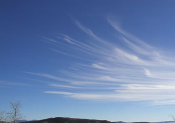
Above: Cirrostratus
Cirrostratus
Cirrostratus clouds are the largest of high level clouds to be found at heights in excess of 16,000 feet. Sometimes the whole sky can be covered by a cirrostratus cloud formation.
What are cirrostratus clouds?
Cirrostratus clouds are high level clouds that are formed of water particles that have been turned to ice crystals. Even if the cloud is some kilometers thick it is still possible to see a watery sun or moon though them. When the cirrostratus cloud forms with a constant flat sheet look, you may be able to see a halo around the sun or the moon. The halo is caused by the rays of light from the sun shine or moon shine being reflected off the ice crystals that make up this cloud.
Types of cirrostratus clouds
- Cirrostratus duplicatus
- Cirrostratus nebulosus
- Cirrostratus fibratus
- Cirrostratus undulatus
What height are cirrostratus clouds found?
Cirrostratus clouds are found at heights above 16,000 feet above cold land or cold water, up above 25,000 feet above tropical or hot ground. They form when water particles turn to ice crystals; these ice crystals give the cirrostratus clouds their normal bright white color.
Classification of cirrostratus clouds
The cirrostratus cloud is given a classification by the World Metrological Organization as Cs Cirro =C Stratus=s. Specific variants of the cirrostratus cloud such as the cirrostratus nebulosus cloud has an additional suffix.
How are cirrostratus clouds formed?
Cirrostratus clouds are formed during periods of peaceful weather, but their formation normally indicates that a period of fine weather is coming to an end. It is normal to expect a deterioration of the weather conditions within 12 to 24 hours after cirrostratus clouds have been observed. The necessary conditions for their formation are as follows:
- Light winds at ground level able to propel water particles into the atmosphere
- Steady convergence from the warmer air to move the water particles to the upper atmosphere
- No intervening cloud layers to block the rising water particles
- Slow decline in air pressure to allow warm fronts of weather to arrive
- Crystallization at heights from 16,000 feet upwards to allow the cirrostratus clouds to form
What do cirrostratus clouds look like?
Cirrostratus clouds can appear as a hazy white blanket that can completely cover the sky. The main cloud cover can be preceded by cirrostratus fibratus that is often the first indication that cirrostratus cloud is arriving.
How common are cirrostratus clouds?
They are quite common and can be seen all around the world. One of the features of cirrostratus clouds is that they can be carried long distances from where they are formed. If they are formed at the levels of jet streams, they can be carried along at a speed of up to 100 miles an hour; therefore they can cover the sky quite quickly.
Where can I see cirrostratus clouds?
Cirrostratus clouds can be seen anywhere in the world, as they are high altitude clouds they are also able to be seen from a long distance away as much as 100 kilometers if the visibility is good. You will be able to see them if you are in a place where the air pressure is falling and a warm front moving in, often bringing bad weather with it.
