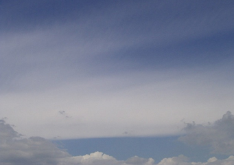
Above: Cirrostratus Fibratus
Cirrostratus Fibratus
Cirrostratus fibratus clouds are able to be identified by their wispy nature and the effect is sometimes referred to as looking like horses tails.
What are cirrostratus fibratus clouds?
Cirrostratus fibratus clouds are high level clouds formed of ice crystals that have been formed from water particles. They are carried from the sea or the ground by winds in an effect called conveyance that drives the water particles upwards. Depending on the air pressure at the time, the cirrostratus fibratus clouds will form at a certain height, the lowest being about 12,000 feet. The look of the cirrostratus fibratus cloud will be determined by the shape of the ice crystals of which it is composed.
What height are cirrostratus fibratus clouds found?
Cirrostratus fibratus clouds will be found at high altitudes typically above 16,000 feet, as you will notice they look wispy and the height of one cloud can be up to 8,000 feet long if there is a steady wind blowing them along. Cirrostratus fibratus clouds normally precede the arrival of cirrostratus nebulosus formations.
Classification of cirrostratus fibratus clouds
The cirrostratus fibratus clouds are part of the cirrostratus family, a class A cloud with the acronym Cs. The fibratus identity adds the suffix Fib. to the definition of the cloud.
How are cirrostratus fibratus clouds formed?
Cirrostratus fibratus clouds are formed by ice crystals, these ice crystals are formed by water particles rising high into the atmosphere. At these levels, jet streams pull the cirrostratus clouds and create the fibratus effect. Cirrostratus fibratus clouds are carried on these fast moving winds and this cause the cirrostratus fibratus effect.
What do cirrostratus fibratus clouds look like?
Cirrostratus fibratus clouds come in a number of different forms, very often they appear as wispy trails that seem to curl up, if you are looking at them moving into the sky where you are located. They will also change shape quite rapidly as they are being driven by the high speed jet stream winds. Normally you can see them disappear or be absorbed by the more extensive cirrostratus clouds as they arrive.
How common are cirrostratus fibratus clouds?
Cirrostratus fibratus clouds can be seen before and after bad weather has come, often the last remnants of a storm, such as a cyclone or an anvil cumulonimbus has passed you can see cirrostratus fibratus cloud remnants in the sky. Key features of these clouds include:
- A wispy rapidly changing appearance
- Dissolving and reforming in different shapes
- Normally at night they will disappear
- Cirrostratus fibratus clouds indicate a warm front is arriving and pressure is dropping, unless a storm has recently passed
Where can I see cirrostratus fibratus clouds?
Cirrostratus fibratus clouds can be seen practically anywhere. They are most commonly seen in the morning after sunrise or in the mid to later part of the afternoon. In the United States the least likely time to see cirrostratus fibratus clouds is at midday during the summer, but in the winter they can be seen across the USA at any time including the night.
