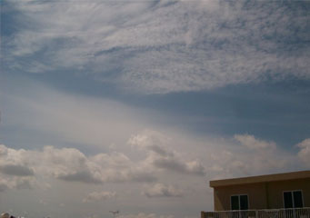
Above: Stratus Praecipitatio
Stratus Praecipitatio
Stratus opacus clouds, one of the varieties of stratus clouds, belong to the category of low-level clouds along with stratus translucidus and stratus undulatus. All species and varieties of stratus clouds, including stratus opacus clouds, have a uniform base and form horizontally layered. They are also colored gray, light gray or close to white and they bring about a cloudy day in the areas where they form.
What are stratus praecipitatio clouds?
Stratus praecipitatio clouds are a low level cloud that typically forms at between 2,000 and 6,500 feet. Caused by water particles gradually rising thanks to a warm front coming in they will gradually get thicker and be able to absorb more moisture until they have reached a point that they are saturated. At this point they will begin to lose their load either in the form of drizzle or light rain. In winter time in cold climates this precipitation can come in the form of light snow or snow flurries.
What height are stratus praecipitatio clouds found?
Stratus praecipitatio clouds are found at low level, like other forms of stratus clouds they can typically be found at heights of between 2,000 to 6,500 feet. Whereas other status clouds will rarely produce rain, stratus praecipitatio clouds are thick enough to cause rainfall, as they will reach the higher levels where they must shed the water moisture they have accumulated.
Classification of stratus praecipitatio clouds
Stratus praecipitatio is a class C low altitude cloud in order to differentiate from the more fast forming and definitely more potentially active cumulus clouds that have the suffix St to indicate that they are of the stratus type. Together this means their classification is C-St.
How are stratus praecipitatio clouds formed?
Stratus praecipitatio clouds are formed by an approaching warm front that progressively allows stratus clouds to form, assuming that the condition of a gradual arrival leading to the stratus clouds to continue. Stratus praecipitatio clouds are the thickest stratus clouds.
What do stratus praecipitatio clouds look like?
They are normally relatively featureless and will partially or fully cover the sky. Initially they may be light grey but progressively they will darken as they absorb more moisture. Stratus praecipitatio clouds can be defined as such once they cause precipitation to occur and rain starts to fall. Assuming the air pressure conditions do not change they can continue to rain for a long period of time as they draw the water particles they need from the ground or sea below them.
How common are stratus praecipitatio clouds?
You will be able to find stratus praecipitatio clouds in the following conditions:
- A warm front that has moved in and air pressure is relatively low
- A continuous stratus cloud that has a good depth sufficient to hold enough water moisture to cause rain to fall
- Relatively static weather conditions with little rise or fall in temperature between the ground and the cloud base
Where can I see stratus praecipitatio clouds?
You can see these clouds in any temperate part of the globe; they are less common in tropical regions or over the Arctic or Antarctic, nor will you find them over arid hot locations such as the Gobi desert.
