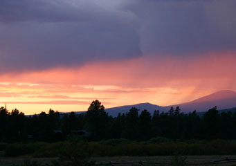
Above: Stratocumulus Praecipitatio
- Home
- Stratocumulus
- Stratocumulus Castellanus
- Stratocumulus Cumulogenitus
- Stratocumulus Duplicatus
- Stratocumulus Lacunosus
- Stratocumulus Lenticularis
- Stratocumulus Mamma
- Stratocumulus Opacus
- Stratocumulus Perlucidus
- Stratocumulus Praecipitatio
- Stratocumulus Radiatus
- Stratocumulus Stratiformis
- Stratocumulus Translucidus
- Stratocumulus Undulatus
- Stratocumulus Virga
Stratocumulus Praecipitatio
Stratocumulus praecipitatio clouds are low level clouds that release light rain or drizzle. When rain or precipitation is released from the stratocumulus clouds these can form smaller cloud variations on their way from the sky down to earth. Whereas virga trails are made when the cloud is high enough in the sky to allow their formation, which allows the water to evaporate before contact with earth is made. Stratocumulus praecipitatio clouds are formed when the low level clouds are too close to the earth to allow the formation of virga trails. These clouds can be seen and labeled correctly and rain will always fall due to the proximity of the clouds to the earth.
What height are stratocumulus praecipitatio clouds found?
Stratocumulus clouds are considered to be low level clouds. Generally speaking, there are three heights of cloud formations. These are, low level, medium level and high level. Low level clouds include:
- Stratus undulates
- Stratus nebulosus
- Stratus lenticularis
- Stratus praecipitatio
- Stratus opacus
- Stratus fractus
- Stratus translucidus
Low level clouds are generally formed anywhere up to 6,000 feet. Clouds can also be seen actually on the earth, although we term this as mist or fog. However, if you can imagine how fog looks, then you will get some idea of how it looks in the air as the principle is the same.
Classification of stratocumulus praecipitatio clouds
The praecipitatio clouds are not confined to stratocumulus as they can also be attached to other kinds of clouds. Praecipitatio is just another word that means rain.
How are stratocumulus praecipitatio clouds formed?
Stratocumulus praecipitatio clouds are formed when a difference in air temperature meets. Usually this means moist, warm air rises to meet a colder stream of air. This effect can take place anywhere from the ground up, so we can witness stratocumulus praecipitatio clouds around us as fog.
What do stratocumulus praecipitatio clouds look like?
Stratocumulus praecipitatio clouds are another of the layered clouds. That said, the layers are generally not visible as they extend up into the sky. They appear to us rather as a thick gray blanket over the sky. The density of these kinds of clouds can vary from, on average, 1 kilometer thick up to as much as 1000 kilometers in thickness.
How common are stratocumulus praecipitatio clouds?
Stratocumulus praecipitatio clouds can be found in many areas of the world wherever you would expect to find rain. Although these are not the clouds that are associated with huge downpours, like cumulonimbus clouds, however, they can give a good soaking.
Where can I see stratocumulus praecipitatio clouds?
Stratocumulus praecipitatio clouds are more common in regions where there is a consistent change of air temperatures. The UK is a very common place for this type of cloud formation due to the constant stream of different air movements fluctuating between warm and cold. As it is difficult to see how high these types of clouds are, it can be difficult to predict how long the rain will continue to precipitate. Although, if there are only gray clouds as far as the eye can see, you can expect a good quota of rain.
