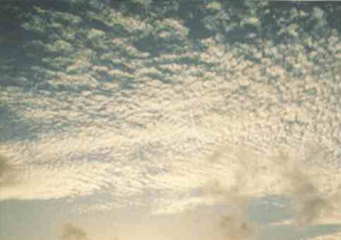
Above: Cirrocumulus
Cirrocumulus
The cumulonimbus shares the same property with cirrocumulus in the sense that they have water droplets only in a super-cooled state. Nearly frozen, ice crystals are the dominant component of the cirrocumulus and cumulonimbus.
Classification of cirrocumulus clouds
Albeit to the popular belief that very few clouds have ice crystals inside them, and can cause snow, cirrocumulus clouds do, and they are very common. This cloud is among the three major types of clouds. Its name is derived from cirrus and cumulus. These clouds have subtypes that include the cirrostratus clouds, as well as many other cirrus clouds.
Types of cirrocumulus clouds
- Cirrocumulus virga
- Cirrocumulus castellanus
- Cirrocumulus lacunosus
- Cirrocumulus floccus
- Cirrocumulus undulatus
- Cirrocumulus mamma
- Cirrocumulus lenticularis
- Cirrocumulus stratiformis
What height are cirrocumulus clouds found?
They occur at an altitude between 16,000 ft and 39,000 ft and like all other cumulus clouds, these signify convection. There are very small amounts of liquid water in this type of cloud, which differentiates it from other cirrus clouds.
The process by which these clouds create ice or snow also produces precipitation, and a form of virga. The virga is a form of precipitation that includes ice and snow fall. Though these clouds are very commonly seen, they are short lived. The term may refer to a number of cloud sub-types, all of which possessing the same distinctive quality of the cirrocumulus cloud. An element or subtype of this type of cloud is often referred to as a cloudlet.
What do cirrocumulus clouds look like?
The appearances of these clouds, much like all other types of clouds, will vary according to their relative position and altitude of location. Other factors, such as the amount of light passing through them and the amount of shade cast, as well as the position of the person looking at them, will also affect the perception of the appearance of clouds. That being said, it's important to take consideration of these things when looking at clouds like this one. One more reason why that's very important is because the cirrocumulus is a generally large cloud. In certain enclosed places, such us in between buildings, it might seem to a person that this cloud can cover an entire horizon. Therefore, it would only look overcast and as if there were no clouds there.
They are very large, as said above, and can cast gray shadows. Their depth makes them seem tuft or gray at times, but these clouds are often seen as a patch of white up on the sky. The cloudlet appears no larger than the size of a finger, in relation to the size of the arm, if the arm is the size of the entire cloud. These cloudlets have finer appearances compared to the rest. They are also often called the mackerel and herringbone, because that's what they look like.
To sum up, this type of cloud occurs at higher altitudes compared to the altocumulus clouds. That is why the cloudlets often appear smaller than they really are. If a person is observing from ground level, then the cirrocumulus would look considerably larger than its cloudlets. Since they never cast self-shadows, they can be translucent at lower levels.
